Drone Mapping
Done Right
Are you struggling with
Dronify helps you avoid costly rework
with fast, precise drone mapping.
Industry-Leading Drone Services
Certified operations with proven track record across Malaysia
RCoC-B Certified
Civil Aviation Authority Malaysia
Malaysia Book of Records
Longest River Survey Achievement
100% Safety Record
Zero Incidents Since Operations
Notable Projects
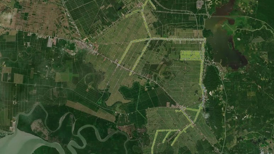
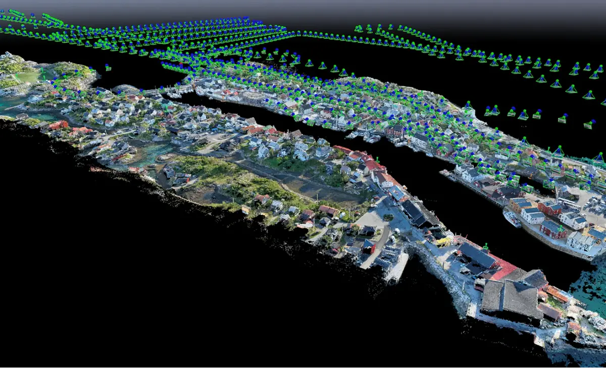
300km Canal Systems Mapping
Comprehensive aerial mapping of extensive canal networks with centimeter-level precision for water infrastructure monitoring.
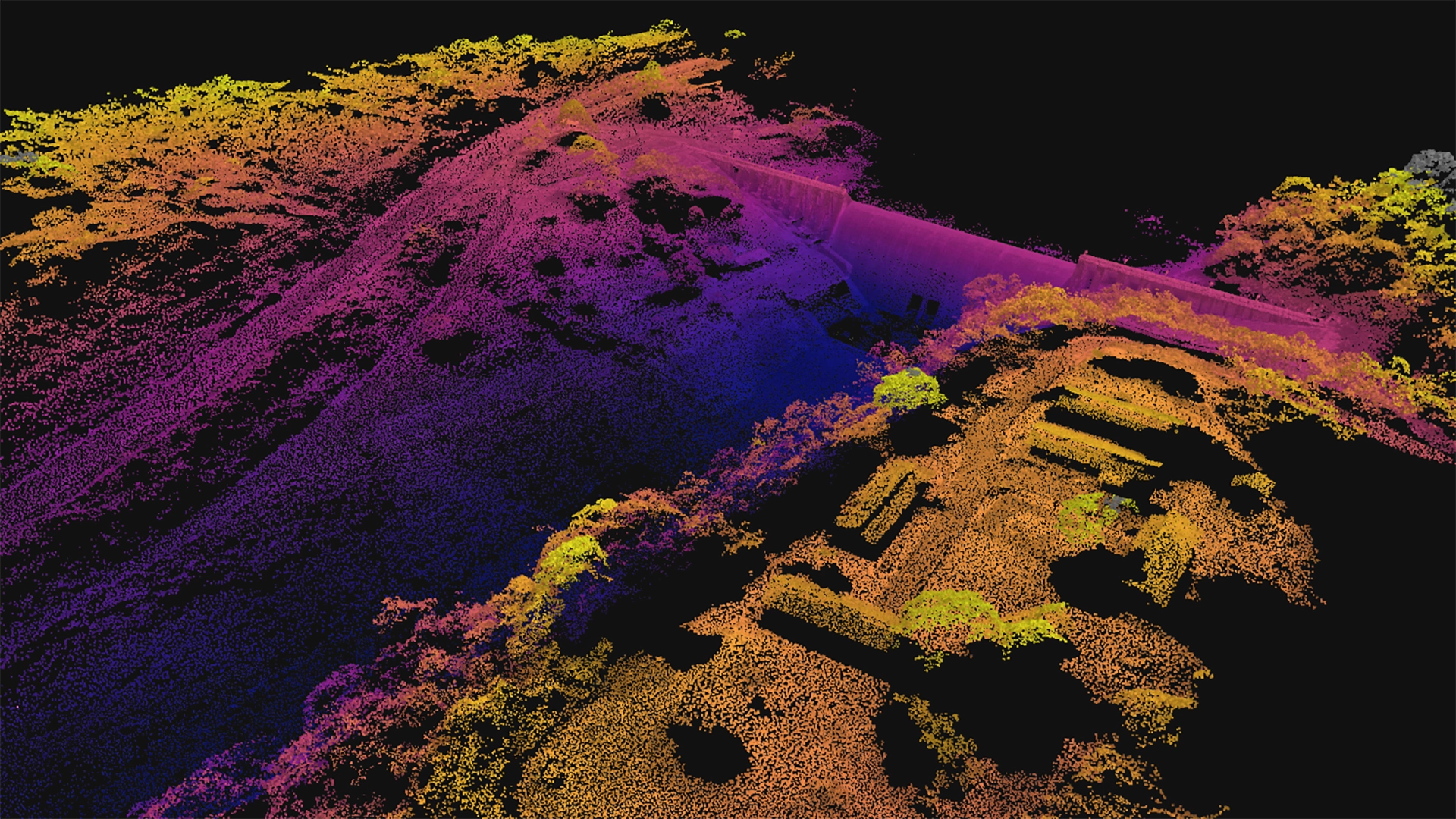
Reservoir Dam Structural Survey
Detailed inspection and 3D modeling of critical water infrastructure for structural integrity assessment and maintenance planning.
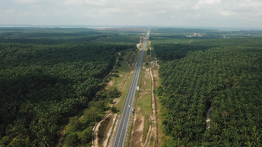
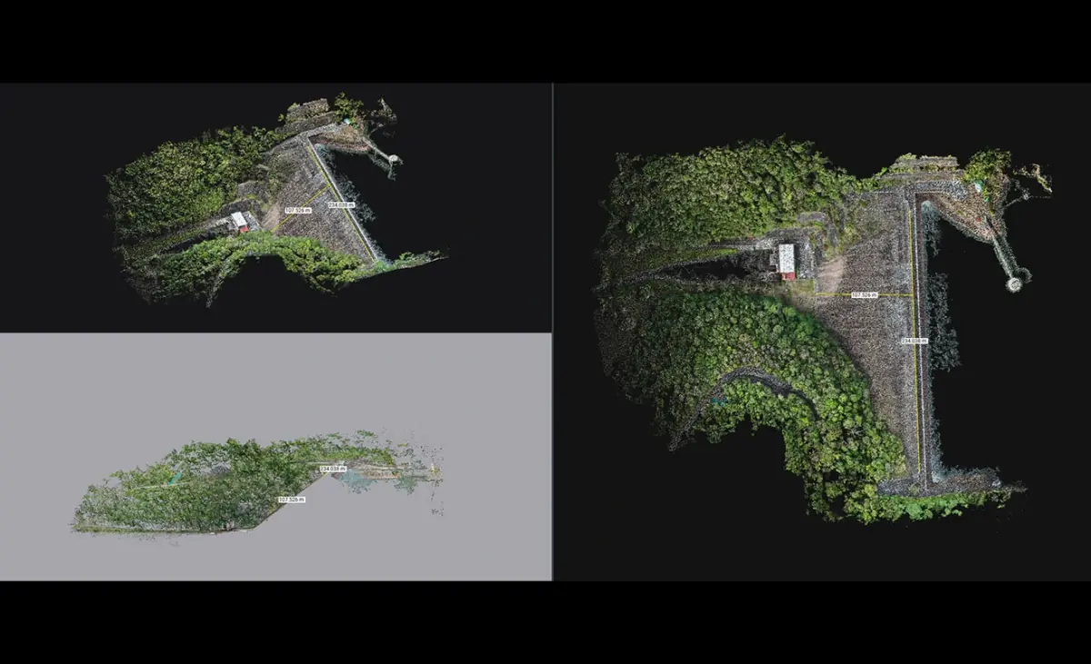
26km Highway Expansion Survey
Comprehensive topographic mapping and obstruction detection for major highway expansion project with GIS-ready deliverables.
Why Choose Dronify
Professional solutions tailored to your needs
Proven Track Record
500+ successful flights with perfect safety record
Advanced Technology
Cutting-edge solutions for precise, efficient data handling
Complete Solutions
From capture to CAD-ready deliverables
Client-Focused Solutions
Customized solutions for your specific needs
How It Works
Transforms raw aerial data into actionable insights
CAPTURE
PROCESS
DELIVER
How It Works
Transform aerial data into actionable intelligence
Capture
Automated flight paths capture comprehensive aerial data with precision GPS positioning
Our drones follow pre-programmed routes ensuring complete coverage with optimal image overlap. Strategic ground control points anchor the dataset to real-world coordinates, while RTK positioning achieves centimeter-level precision.
Process
Advanced algorithms transform raw imagery into precise 3D models and orthomosaics
Sophisticated photogrammetry algorithms analyze thousands of overlapping images to generate accurate 3D point clouds. Multi-stage validation ensures data integrity, creating detailed elevation models and orthomosaics for comprehensive site analysis.
Deliver
Receive comprehensive data packages optimized for your workflow & CAD integration
Complete package includes high-resolution orthomosaics, 3D models, point clouds, and detailed reports. All data delivered in industry-standard formats compatible with popular CAD and GIS software, ensuring seamless integration into your existing workflows.
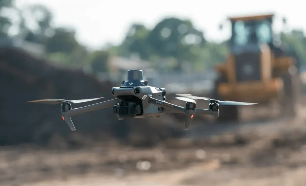
On-site Data Capture
Specialized drones follow pre-planned routes to capture thousands of overlapping aerial images with GPS precision and ground control points for survey-grade accuracy.
Post-Processing
Captured images are transformed into a detailed 3D point cloud - creating a digital twin that serves as the foundation for accurate maps, models, and measurements.
Deliverables Generation
Receive comprehensive data packages including orthomosaics, 3D models, and reports in CAD/GIS compatible formats with fast turnaround.
6 GAME-CHANGING BENEFITS
See why industry leaders in construction, surveying, real estate, and beyond are making drone solutions their competitive advantage.
TIME & COST EFFICIENCY
Get more done with less resources and time.
PRODUCTIVITY BOOST
Faster, more efficient operations with automated data collection and real-time insights
AUDIT-PROOF RECORDS
Generate comprehensive, accurate records for compliance and future reference
CLEAR COMMUNICATION
Clear visual data ensures everyone is on the same page
COMPETITIVE EDGE
Stay ahead with cutting-edge technology and superior deliverables
PRIORITIZE SAFETY
Eliminate human risk in hazardous inspections and hard-to-reach areas