Orthomosaic Maps in Construction Project Management
Comprehensive guide to implementing orthomosaic mapping for construction monitoring and documentation.
Read ArticleTechnical specifications for achieving survey-grade accuracy in drone mapping. Comprehensive guide covering GCP placement, RTK integration, coordinate systems, and quality assurance protocols for professional surveying applications.
Achieving survey-grade accuracy in drone mapping requires a systematic approach that combines precise Ground Control Points (GCP) implementation with Real-Time Kinematic (RTK) integration. This comprehensive technical guide provides the specifications, methodologies, and quality assurance protocols necessary for professional surveying applications that demand sub-centimeter accuracy.
Survey-grade accuracy typically refers to positional accuracy of ±2-5cm horizontally and ±3-7cm vertically, meeting professional standards for cadastral surveys, engineering projects, and regulatory compliance. This level of precision is achieved through careful planning, proper equipment configuration, and rigorous quality control procedures.
Survey-grade accuracy standards are defined by various national and international surveying organizations. Understanding these requirements is crucial for project planning and execution.
The choice of accuracy class depends on the project requirements, regulatory standards, and intended use of the survey data. Critical infrastructure projects typically require Class A accuracy, while general mapping applications may accept Class C standards.
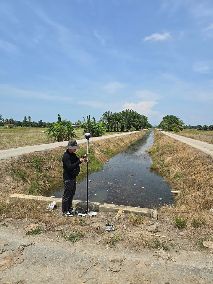
Ground Control Points serve as the foundation for achieving survey-grade accuracy. These precisely surveyed reference points provide the geometric framework for photogrammetric processing and coordinate system transformation.
Optimal GCP distribution is critical for achieving uniform accuracy across the survey area. The number and placement of GCPs directly impact the final accuracy of the photogrammetric output.
| Survey Area | Minimum GCPs | Recommended Distribution | Maximum Spacing |
|---|---|---|---|
| < 1 ha | 5-7 points | 4 corners + center | 100m |
| 1-10 ha | 8-12 points | Grid pattern | 200m |
| 10-50 ha | 15-25 points | Systematic grid | 300m |
| > 50 ha | 1 per 2-3 ha | Network approach | 500m |
Proper GCP target design ensures reliable identification and measurement during photogrammetric processing. Target specifications must consider visibility, contrast, and environmental conditions.
GCP coordinates must be determined using high-precision surveying techniques. The accuracy of GCP coordinates directly impacts the final mapping accuracy.
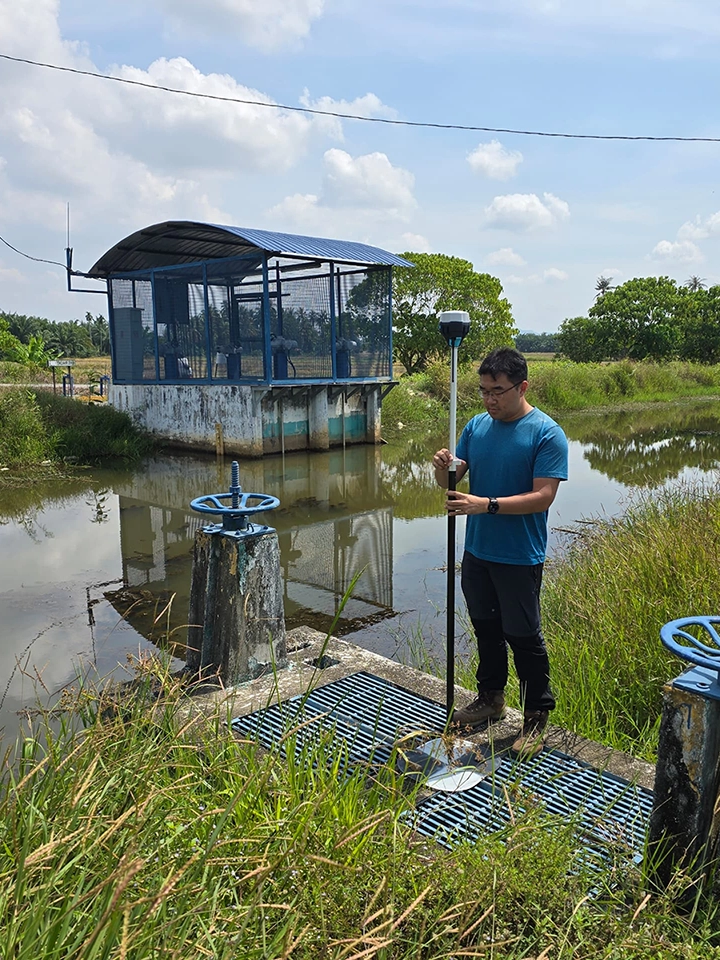
RTK GNSS integration provides real-time positioning accuracy, reducing the dependency on traditional GCPs while maintaining survey-grade precision. This technology enables direct georeferencing of aerial imagery with centimeter-level accuracy.
A complete RTK system consists of base station, rover (drone-mounted), and communication link. Each component must meet specific technical requirements for reliable operation.
Proper RTK configuration on the drone platform is essential for achieving consistent accuracy throughout the flight mission. Integration with flight control systems enables real-time quality monitoring.
Both Real-Time Kinematic (RTK) and Post-Processed Kinematic (PPK) methods can achieve survey-grade accuracy. The choice depends on operational requirements and site conditions.
| Aspect | RTK | PPK |
|---|---|---|
| Real-time accuracy | ✓ Immediate | ✗ Post-flight processing |
| Communication dependency | ✗ Requires radio link | ✓ No real-time link needed |
| Processing complexity | ✓ Automated | ✗ Manual processing required |
| Final accuracy | 1-2cm | 1-2cm |
| Operational range | Limited by radio | Unlimited |
Proper coordinate system selection and transformation procedures are fundamental to achieving survey-grade accuracy. Understanding datum relationships and projection parameters ensures consistent results across different survey projects.
The choice of geodetic datum affects the absolute positioning accuracy and compatibility with existing survey infrastructure. Modern surveys typically use WGS84 or national datums with precise transformation parameters.
Map projections minimize distortion for specific geographic regions. Survey projects require appropriate projection selection to maintain accuracy across the project area.
Coordinate transformation accuracy must be validated through independent check points and statistical analysis. Residual analysis identifies systematic errors and transformation quality.
Survey-grade photogrammetric processing requires specific parameter settings and quality control procedures. Processing workflow optimization ensures consistent accuracy while maintaining computational efficiency.
High-quality imagery forms the foundation of accurate photogrammetric processing. Image specifications must meet minimum requirements for professional surveying applications.
Processing parameters significantly impact final accuracy and processing time. Optimal settings balance accuracy requirements with computational resources.
Bundle adjustment is the core mathematical process that determines camera positions and orientations. Proper optimization ensures geometric consistency throughout the survey area.
Comprehensive quality assurance protocols ensure that survey-grade accuracy requirements are met consistently. Systematic validation procedures identify potential issues before final deliverable production.
Thorough pre-flight planning and equipment validation prevent accuracy degradation due to systematic errors or equipment malfunction.
Real-time monitoring during flight operations enables immediate corrective action if accuracy parameters drift outside acceptable limits.
Systematic quality control procedures validate processing results and identify potential accuracy issues before final delivery.
Professional accuracy reporting provides transparent documentation of survey methods, results, and limitations. Proper documentation supports regulatory compliance and professional standards.
Experience-based best practices help avoid common pitfalls that can compromise survey accuracy. Understanding typical issues and their solutions enables consistent high-quality results.
Symptoms: Intermittent positioning accuracy, float solutions
Solutions:
Symptoms: Poor photogrammetric accuracy, large coordinate residuals
Solutions:
Symptoms: Bundle adjustment fails to converge, poor tie point quality
Solutions:
The evolution of survey-grade mapping technology continues to improve accuracy, efficiency, and automation. Understanding emerging trends helps plan for future capability requirements.
Integration of GPS, GLONASS, Galileo, and BeiDou constellations improves positioning accuracy and reliability, especially in challenging environments.
Machine learning algorithms improve automatic tie point detection, image matching, and quality control procedures, reducing manual intervention requirements.
Advanced algorithms provide real-time accuracy assessment during flight operations, enabling immediate corrective actions.
Distributed processing capabilities enable faster turnaround times and access to advanced algorithms without local hardware investments.
Modern survey workflows integrate drone mapping with conventional surveying methods, creating comprehensive survey solutions that leverage the strengths of each technology.
Survey-grade accuracy in drone mapping requires systematic implementation of proven methodologies, rigorous quality control, and proper integration of GNSS technology. Success depends on careful attention to every aspect of the workflow, from initial planning through final deliverable production.
The investment in proper equipment, training, and procedures pays dividends through consistent, reliable results that meet professional surveying standards. As technology continues to advance, the principles outlined in this guide remain fundamental to achieving survey-grade accuracy.
Dronify's survey-grade mapping solutions combine advanced technology with proven methodologies to deliver consistent, accurate results for your professional surveying projects.
Discuss Your Survey Requirements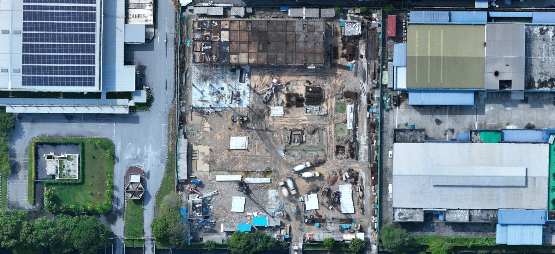
Comprehensive guide to implementing orthomosaic mapping for construction monitoring and documentation.
Read Article
Technical implementation guide for multispectral imaging in agricultural monitoring and yield optimization.
Coming Soon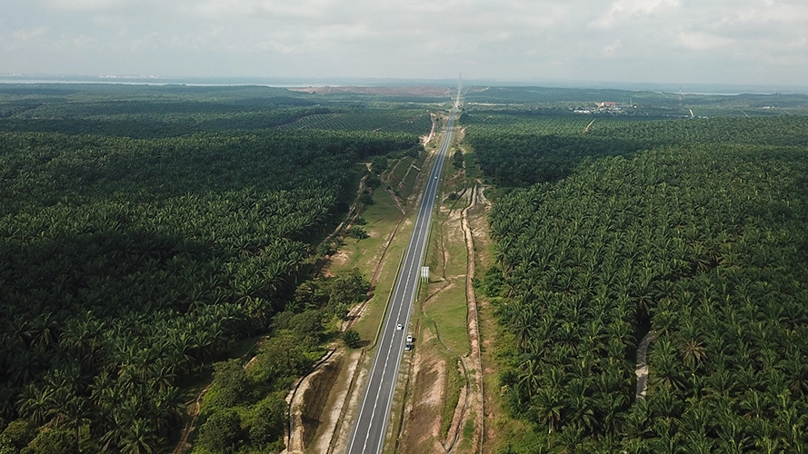
Complete technical analysis of highway expansion project from initial survey to final documentation.
Coming Soon